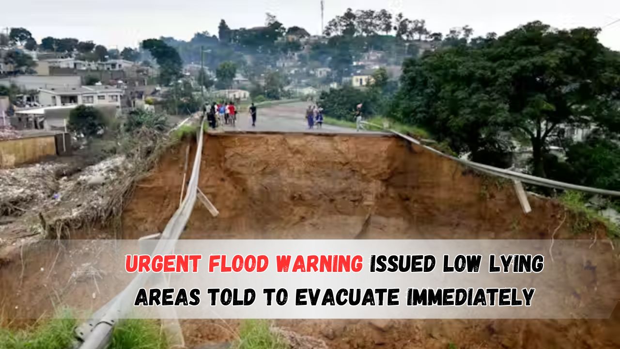
Western Cape Heavy Rainfall – The Western Cape is currently bracing for one of its most intense weather events in recent history, as the South African Weather Service (SAWS) has issued a high-level flood alert due to severe rainfall between June 26 and June 28, 2025. The heavy downpour is expected to impact most parts of the province, with the most dangerous flooding forecasted in low-lying areas such as parts of Cape Town, George, and surrounding districts. The provincial disaster management teams have already activated emergency protocols and are coordinating evacuations for at-risk communities. Residents in flood-prone zones have been urged to leave immediately, while shelters are being prepared to accommodate displaced families. As of June 26, thousands have already been relocated as rivers rise and roads become inaccessible. Authorities have stated that the rainfall levels are expected to exceed 80mm in some areas within a 24-hour period, raising fears of flash floods, mudslides, and widespread infrastructural damage. Key services including transport, power supply, and water sanitation could be severely disrupted. The storm system, originating from the southwest Atlantic, is bringing not just rain but also strong winds exceeding 60 km/h in certain coastal towns. As the emergency response continues, residents are advised to stay informed via official channels, avoid unnecessary travel, and keep emergency kits ready. The below sections provide complete details on rainfall intensity, affected zones, precautionary measures, emergency contact numbers, and more.
Western Cape Heavy Rainfall Forecast and Warning Timeline
Authorities expect extreme weather patterns over a 72-hour window. Below are the projected rainfall patterns and regions under immediate threat:
- The most affected areas include Cape Flats, Overberg, Garden Route, and parts of the Winelands.
- Rainfall intensity will peak on June 27, with flash flood potential highest between 2 AM and 8 AM.
Rainfall Impact Table: June 26–28, 2025
| Date | Region Affected | Rainfall (mm) | Flood Risk Level | Wind Speed (km/h) | Evacuation Status | Power Risk | Road Access |
|---|---|---|---|---|---|---|---|
| June 26 | Cape Town | 45 | Moderate | 40 | Voluntary | Low | Partially Open |
| June 26 | George | 55 | High | 50 | Mandatory | Moderate | Delays Expected |
| June 27 | Overberg | 85 | Critical | 60 | Ongoing | High | Multiple Closures |
| June 27 | Cape Flats | 90 | Critical | 55 | Mandatory | High | Closed in zones |
| June 28 | Winelands | 70 | High | 40 | On Standby | Moderate | Delays Expected |
| June 28 | Knysna | 60 | High | 45 | On Alert | Moderate | Partial Closures |
| June 28 | Mossel Bay | 50 | Moderate | 30 | No Action | Low | Open |
| June 28 | Beaufort West | 20 | Low | 20 | No Action | None | Open |
Key Areas Under Evacuation and Risk Alert by Western Cape Heavy Rainfall
Due to rising water levels and saturated soil, the following locations have already begun evacuation procedures or are on emergency standby.
- Cape Flats informal settlements near Philippi and Khayelitsha
- George townships, especially along the riverbanks
- Parts of the Langeberg and Swartland areas
- Coastal zones in Hermanus, Gansbaai, and Mossel Bay
High-Risk Municipalities and Communities
The Western Cape government has categorized specific localities as “High-Risk Zones” based on terrain and infrastructure vulnerabilities.
| Municipality | Primary Risk | Actions Advised | Contact Point |
|---|---|---|---|
| City of Cape Town | Flash floods | Evacuate low-lying zones | 0800 110 011 |
| Garden Route | River overflow | Relocation in progress | 044 803 1300 |
| Overstrand | Coastal surge | Avoid beach access areas | 028 313 8000 |
| Stellenbosch | Mudslide threat | Relocate near mountain base | 021 808 8911 |
| Knysna | Waterlogging | Monitor local alerts | 044 302 6300 |
Emergency Services, Shelters, and Helpline Information
Multiple shelters have been opened in school buildings, community halls, and churches. Emergency teams are prioritizing elderly residents, children, and those with health conditions.
- The Disaster Risk Management Centre is operating 24/7.
- Emergency hotlines have been boosted with extra staff.
Official Emergency Contacts and Shelter Locations
| Region | Emergency Shelter Address | Helpline Number | Notes |
|---|---|---|---|
| Cape Town | Athlone Stadium Hall | 0800 110 011 | Capacity: 500+ |
| George | Thembalethu Community Hall | 044 874 8816 | Beds, meals provided |
| Hermanus | Protea Hall, Voëlklip | 028 313 8000 | Pets allowed |
| Stellenbosch | Idas Valley Primary School | 021 808 8911 | Medical team onsite |
| Paarl | Drakenstein Hall | 021 807 7000 | Generator backup available |
Public Advisory: Safety Measures for Households
Residents who are not under mandatory evacuation but reside in flood-prone regions are advised to take immediate precautionary steps.
- Secure documents and valuables in waterproof containers.
- Store at least 3 days’ worth of food and drinking water.
- Avoid all forms of travel during peak rainfall hours.
Household Flood-Readiness Checklist
| Task | Recommended Action |
|---|---|
| Emergency Kit Prepared | Torch, radio, meds, power bank |
| Home Sandbagging | Around doorways, drains |
| Electricity Precaution | Switch off plugs and breakers |
| Vehicle Safety | Park on elevated surface |
| Pet Relocation Plan | Prepare crate or shelter |
| Family Communication Setup | Share contact locations |
| Local Authority Alerts | Enable app/WhatsApp updates |
Timeline of Government Response and Weather Developments
The Western Cape Provincial Government issued its first red-level alert on June 24, based on satellite data from SAWS. Local municipalities followed with evacuation notices and logistical support.
Chronological Response and Updates
| Date | Event Description |
|---|---|
| June 24 | Red-level weather alert issued by SAWS |
| June 25 | Disaster Management teams activated |
| June 26 | First evacuations begin in Cape Flats and George |
| June 27 | Peak rainfall expected, most shelters at full capacity |
| June 28 | Risk reassessment to decide on return timeline |
Transportation Disruptions and Road Closures
With multiple roads submerged or blocked by debris, major disruptions have hit transport routes. Rail services remain suspended in flooded areas.
- N2 highway near Sir Lowry’s Pass is closed in both directions.
- Golden Arrow bus routes are diverted in Cape Town metro.
- Emergency services are prioritizing rescue and clearance.
Water and Power Supply Interruptions Expected
Residents should prepare for interruptions in water supply due to pipe bursts and dam overflow protection. Similarly, power stations may undergo controlled shutdowns.
- Eskom has warned of local outages in George, Mossel Bay, and Grabouw.
- Municipal water departments have issued boil notices in low-pressure zones.
This emergency situation remains fluid, and residents are urged to remain calm but vigilant. Always verify information through official government sources. Compliance with evacuation and safety guidelines can save lives.
FAQs of Western Cape Heavy Rainfall
Q1: Is the entire Western Cape under evacuation?
No, only specific low-lying and high-risk areas such as parts of Cape Flats, George, and Overberg have mandatory evacuation orders.
Q2: How long will the rainfall last?
The intense weather system is expected to last until the evening of June 28, with the most critical rainfall on June 27.
Q3: Are schools closed during this emergency?
Yes, all schools in high-alert zones have been instructed to suspend operations until at least June 29.
Q4: What should I do if I’m stuck and need help?
Call the Western Cape Disaster Management Centre at 0800 110 011 or approach your nearest shelter. Emergency teams are deployed.
Q5: Can I receive real-time updates via mobile?
Yes. Enable notifications from the SAWS app or follow @WesternCapeGov on social platforms for official updates.