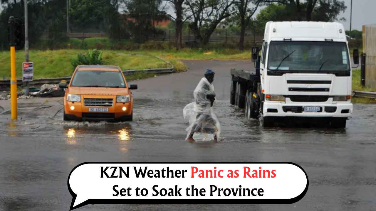
SA Weather Alert – As the winter storm systems intensify across South Africa, the South African Weather Service (SAWS) has issued a strong weather warning for parts of the Eastern Cape and KwaZulu-Natal. From August 7 to 10, 2025, these provinces are expected to experience heavy rainfall, which may lead to localized flooding, road disruptions, and potential power outages. This comes at a time when several regions have already been battling intermittent rainfall and deteriorating infrastructure. The warning comes as part of a Level 6 weather alert, covering the coastal and inland regions of both provinces. According to meteorologists, a low-pressure system coupled with cold fronts moving in from the southwest will contribute to heavy downpours and possible thunderstorms, particularly in low-lying areas and flood-prone settlements. Residents are urged to take necessary precautions, especially those in informal settlements, riverbanks, and poorly drained zones. Authorities have activated emergency response plans across municipalities. Disaster management units in the Eastern Cape and KZN are on standby for immediate deployment. Essential service departments such as health, transport, and social development are coordinating to ensure swift response should the weather situation deteriorate. This advisory is critical not just for general safety but also for those commuting or depending on essential services during this period. Below is a detailed breakdown of the weather pattern, potential impacts, preparation tips, and government contact points to help citizens stay informed and protected throughout the expected stormy days.
Areas Under Threat by SA Weather Alert from August 7–10
The following areas have been identified by SAWS as high-risk zones during the rainfall warning period.
- Coastal towns along the Wild Coast in Eastern Cape
- Port St Johns, Lusikisiki, and Mthatha
- Margate, Port Shepstone, and Scottburgh in southern KZN
- Durban and surrounding townships
- Pietermaritzburg and inland towns like Kokstad and Harding
- Low-lying rural villages and informal settlements
- Regions with poor drainage and river basins
High-Risk Timeline: Day-by-Day Breakdown
This forecast helps residents prepare in advance by outlining specific areas of impact each day.
| Date | Region Affected | Expected Rainfall | Impact Level | Warnings Issued | Road Risk | Power Disruption Risk | Flooding Possibility |
|---|---|---|---|---|---|---|---|
| Aug 7 (Wed) | Southern KZN, EC Coast | 40–60mm | Moderate | Level 3 Alert | Medium | Low | Localized |
| Aug 8 (Thu) | Eastern Cape Interior | 60–80mm | High | Level 5 Alert | High | Medium | Significant |
| Aug 9 (Fri) | Durban, PMB | 90+mm | Severe | Level 6 Alert | Very High | High | High |
| Aug 10 (Sat) | Northern KZN, Midlands | 40–70mm | Moderate | Level 4 Alert | Medium | Medium | Localized |
Key Safety Measures for Households and Communities
With the risk of flash floods and severe weather disruptions, the following guidelines are advised for all affected residents.
- Avoid unnecessary travel, especially during peak rainfall hours.
- Do not attempt to cross flooded roads or low-lying bridges.
- Charge mobile devices and prepare alternative light sources.
- Keep emergency contacts and medical supplies readily accessible.
- Check drainage systems around homes to avoid water logging.
- Store drinking water in case of service disruption.
- Keep livestock and pets in safe, elevated areas.
What Emergency Services Recommend During Storms
Local authorities are on high alert and request citizens to collaborate for public safety.
- Comply with evacuation orders if issued by disaster teams.
- Share weather updates and alerts with neighbors, especially the elderly.
- Keep a radio or phone tuned to SAWS or municipal channels for live updates.
- Report blocked drainage systems or power outages to your ward councillor or municipality.
- Do not touch fallen power lines or attempt to clear tree debris during rainfall.
Major Infrastructure and Transport Disruptions Expected
Severe weather may significantly disrupt local infrastructure and transport routes.
- Eastern Cape rural roads may become impassable due to mudslides.
- Durban’s metro rail and minibus taxi services could experience delays.
- Coastal roads such as the N2 between Mthatha and Kokstad may be closed temporarily.
- Power lines in Umzinto, Harding, and Mzimkhulu at high risk of damage.
- Drainage backups in informal settlements can lead to household flooding.
- Municipal garbage collection may be delayed due to road inaccessibility.
Potential Power and Water Supply Interruptions
Many parts of the Eastern Cape and KZN could face temporary disruptions in utility services.
| Location | Service At Risk | Type of Risk | Responsible Authority | Response Measures |
|---|---|---|---|---|
| Mthatha | Electricity | Pole Damage, Outage | Eskom, Local Municipality | Mobile units on standby |
| Durban North | Water Supply | Pipeline overflow | eThekwini Water & Sanitation | Tankers deployed |
| Pietermaritzburg CBD | Electricity | Load Instability | Msunduzi Municipality | Restoration crew activated |
| Lusikisiki | Road Access | Landslides | SANRAL, Transport Dept | Grader teams ready |
| Port Shepstone | Drainage | Overflow | Ugu District Municipality | Emergency drain clearance |
| Umzimkhulu | Electricity | Transformer failure | Eskom | Repairs prioritized |
| Kokstad | Water Supply | Dam sedimentation | Local Water Board | Monitoring ongoing |
Provincial Government Actions and Contacts for Assistance
Both provincial and municipal authorities are actively preparing for this weather event.
- Provincial disaster coordination centers activated in Bhisho and Pietermaritzburg.
- Schools in high-risk zones have been advised to consider early closures.
- Public hospitals stocking emergency supplies and reserving beds for weather-related injuries.
- Relief shelters prepared in vulnerable townships for temporary evacuation.
Contact Details for Emergency Help
| Department | Contact Number | Services Provided |
|---|---|---|
| SA Weather Service | 082 162 (Toll-Free) | Weather alerts, rainfall data |
| Eastern Cape Disaster Management | 043 711 1506 | Emergency evacuation, shelter info |
| KwaZulu-Natal Disaster Management | 033 897 3963 | On-ground disaster support |
| eThekwini Municipality Helpline | 080 311 1111 | Power/water outages, flooding reports |
| Eskom (Emergency Line) | 086 003 7566 | Electricity faults |
| Department of Transport KZN | 033 355 8700 | Road closures and alternative routes |
| Red Cross Eastern Cape | 043 722 4440 | Emergency health and relief aid |
Real-Life Impact: Stories from Previous Storms
Communities in these regions have witnessed how unpreparedness can turn deadly. In last year’s August rains, 23 families in rural Matatiele lost their homes due to hillside erosion. In Port Shepstone, a family of five was stranded on their roof for six hours before rescue teams could reach them. These incidents underline the importance of early preparation and community awareness.
Local Volunteers and NGOs Mobilizing Ahead
Several organizations are stepping up to support communities ahead of this storm.
- Gift of the Givers and Red Cross prepping emergency packs.
- Community watch groups coordinating transport for elderly and disabled.
- Rural schools turning into temporary safe shelters.
How You Can Help Your Community
Your involvement can help save lives and reduce damage.
- Offer transport or shelter if safe to do so.
- Share contact info for local help lines with those who may not be digitally connected.
- Participate in local community alert groups via WhatsApp or radio.
- Help clear drains or gutters around your area.
With the weather growing more unpredictable due to shifting climate patterns, timely action, strong local support, and accurate information remain key in safeguarding lives and property. Stay informed, stay prepared, and prioritize your safety first during these critical days ahead.
FAQs of SA Weather Alert
Q1: Will the rain be continuous or in intervals?
It will occur in heavy spells with breaks in between, mostly in the afternoons and evenings.
Q2: Are schools closing during this alert period?
Some schools in flood-prone areas may shut early or stay closed; announcements will be local.
Q3: What if I lose power for more than 6 hours?
Report it to Eskom or your local municipality. Backup crews are being mobilized for restoration.
Q4: Can I travel for work during these dates?
Only if necessary. Avoid travel during peak rain hours and check road safety alerts before leaving.
Q5: Will government shelters be open to anyone?
Yes, especially those in informal housing or at high flood risk will be accommodated as space allows.