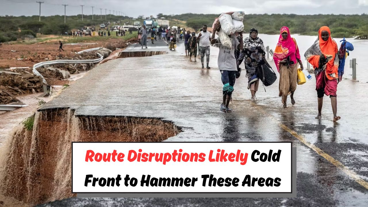
Cold Front and Heavy Rain – A strong cold front is set to sweep across several regions of South Africa this weekend, bringing with it heavy rainfall, plunging temperatures, and potentially hazardous weather conditions. Meteorologists have warned that the front will move in from the southwest, gradually spreading to inland provinces over the next 48 hours. Coastal areas can expect powerful winds, rough seas, and continuous downpours, while inland regions may experience thunderstorms and sharp temperature drops. Farmers, outdoor workers, and travelers are urged to prepare for disruptions, particularly in areas prone to flooding. Emergency services have advised the public to secure loose items, avoid unnecessary travel during peak storm conditions, and monitor official weather alerts closely. With rainfall amounts predicted to be significant in some parts, the risk of localized flooding and road closures is high. Residents are encouraged to take the necessary precautions to protect property and ensure personal safety throughout the duration of this cold and wet weather spell.
Cold Front Arrival and Affected Regions
The approaching cold front is expected to make landfall along the Western Cape coastline late Friday evening, moving rapidly toward the Eastern Cape and KwaZulu-Natal by Saturday morning. Cape Town, George, Port Elizabeth, and Durban are forecast to experience intense rainfall and gusty winds, making driving conditions hazardous. Inland provinces such as the Free State, North West, and Gauteng will likely feel the effects by Saturday afternoon, with temperatures dropping sharply by as much as 10 degrees Celsius. Mountainous regions, especially in the Drakensberg and Lesotho areas, may even experience snowfall, adding to travel disruptions. Authorities have issued yellow level weather warnings for several provinces, cautioning residents about the potential for flash floods, damaged infrastructure, and extended power outages. Travelers are advised to check updated forecasts before setting out, as road closures and delays could affect weekend plans significantly.
Heavy Rainfall and Flooding Risks
Weather models predict that certain areas, particularly the Eastern Cape and KwaZulu-Natal, could receive over 50mm of rain within a 24-hour period, raising serious concerns about flash floods and landslides. Low-lying communities, informal settlements, and regions near rivers and dams are particularly vulnerable to water-related hazards. Emergency management teams have been placed on high alert, ready to respond to rescue operations and provide assistance where needed. Residents are urged to clear drainage systems around their homes to prevent water buildup and to avoid attempting to cross flooded roads or bridges. The South African Weather Service has advised motorists to reduce speed, switch on headlights in heavy rain, and maintain a safe following distance. Given the combination of strong winds and saturated ground, there is also a risk of falling trees and structural damage, which could cause temporary power cuts in affected areas.
Travel Safety and Preparedness Measures
With wet and windy conditions forecast for much of the weekend, authorities recommend that travelers and residents take proactive safety steps. Those planning road trips should consider postponing travel during peak storm periods, especially in high-risk flood zones. Public transport services, including buses and trains, may face delays due to adverse weather and potential track or road damage. Airlines have also cautioned passengers about possible flight disruptions caused by strong crosswinds and poor visibility. Outdoor activities such as hiking, camping, and fishing should be postponed until conditions improve, as rivers and coastal areas may become dangerously unpredictable. Pet owners should ensure animals are sheltered from the cold and rain, while households are advised to stock essential supplies in case of extended power outages. Staying informed through trusted news sources, social media alerts, and official weather updates will be key to navigating the weekend safely.
Community Response and Support Systems
Local municipalities and disaster management centers have activated response plans to deal with the expected impact of the cold front. Community shelters are being prepared in vulnerable areas to assist those affected by flooding or storm damage. Volunteers and NGOs have been mobilized to provide blankets, food parcels, and warm clothing to residents in need. Health officials have also reminded the public to take extra precautions against cold-related illnesses, particularly for children, the elderly, and those with pre-existing medical conditions. Farmers are encouraged to safeguard livestock and agricultural equipment, while schools and community centers may be converted into temporary relief hubs if the situation escalates. The collaboration between emergency services, local government, and community members will be essential in minimizing the impact of the severe weather. Authorities continue to emphasize the importance of early preparation and remaining indoors whenever possible until the storm passes.