Weather Alert – Weather Alert 2025: Heavy Rain And Cold Front Heading To These South African Regions South Africans are being urged to prepare for severe weather conditions as the South African Weather Service (SAWS) issues a high-level warning for heavy rainfall and a strong cold front expected to sweep across several regions this week. Meteorologists predict the cold front will bring widespread showers, thunderstorms, and sharp temperature drops, particularly affecting the Western Cape, Eastern Cape, and parts of KwaZulu-Natal. Coastal areas may experience gale-force winds, while inland regions should brace for icy mornings and potential frost. Authorities are warning residents to take precautions against possible flooding in low-lying areas, road disruptions due to slippery conditions, and interruptions in power supply. Emergency services are on high alert, and disaster management teams have been mobilised to assist vulnerable communities. Farmers have also been advised to safeguard crops and livestock, as the combination of cold weather and excessive rainfall could cause agricultural losses. This weather pattern is expected to persist for several days before gradually clearing.
Expected Impact on Western and Eastern Cape
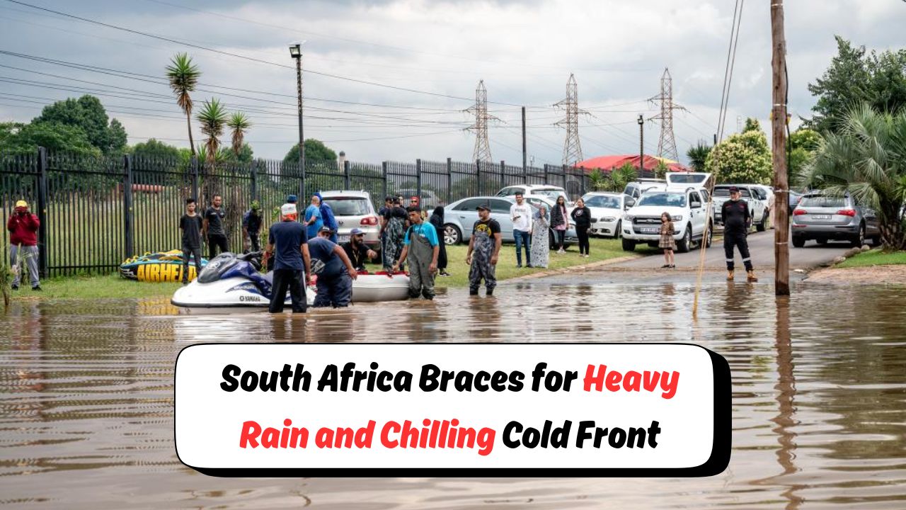
The Western Cape and Eastern Cape are likely to be the hardest hit by this incoming cold front. The SAWS has forecast continuous rainfall for up to 48 hours in some districts, with totals possibly exceeding 60mm in certain mountainous areas. Flood warnings are in place for rivers and streams that may overflow, leading to potential evacuations in flood-prone communities. Cape Town is expected to experience strong south-westerly winds, making sea conditions extremely dangerous for fishing vessels and small boats. In the Eastern Cape, areas like Gqeberha and East London will face heavy downpours, coupled with coastal flooding risks due to high tides and rough seas. Power outages could become a challenge as high winds may damage power lines. Residents are advised to limit travel, keep emergency supplies ready, and monitor weather updates regularly. Authorities have stressed the importance of avoiding waterlogged roads and using alternative routes if necessary.
Cold Conditions Expected in Inland Regions
Inland provinces, including the Free State, Northern Cape, and parts of Gauteng, are expected to experience a significant temperature drop as the cold front moves deeper into the country. Daytime temperatures could plunge below 10°C in some high-altitude areas, while night-time lows may approach freezing point. These conditions could result in frost on farmlands, posing risks to crops and livestock. The SAWS has warned of reduced visibility in the early mornings due to mist and fog, which could impact road safety. Health officials are reminding residents to take extra care to prevent cold-related illnesses, especially among children and the elderly. Schools in colder regions are also being advised to ensure adequate heating in classrooms. Additionally, motorists are being urged to drive cautiously, as icy patches could develop on roads, particularly on elevated bridges and mountain passes. The public is encouraged to wear layered clothing and limit unnecessary outdoor exposure during peak cold hours.
Safety Measures and Government Response
Government disaster management teams and local municipalities are already on standby to respond to weather-related emergencies. Shelters have been prepared in case evacuations are needed in flood-affected areas. The Department of Transport has deployed teams to inspect and monitor critical road networks, especially those vulnerable to flooding and landslides. In coastal regions, port authorities are issuing advisories to restrict small-craft activity during periods of strong winds and rough seas. Residents in rural areas are being urged to check on elderly neighbours and ensure that animals have adequate shelter. Emergency hotlines are being circulated widely, and social media channels are being updated regularly with the latest weather alerts. Communities are also being encouraged to store extra food, drinking water, and essential medicines in case of prolonged disruptions. While the heavy rainfall could help replenish water reserves, officials warn that the immediate risks of flooding and cold exposure must be taken seriously.
Long-Term Weather Outlook
According to SAWS, this severe weather event is part of a larger climate pattern influencing the southern African region. Meteorologists note that while such cold fronts are typical for winter, the intensity of rainfall and wind speed in this case is higher than average for August. Long-range forecasts suggest that the cold front will move eastward and weaken after three to four days, allowing for a gradual return to milder conditions by the end of the week. However, another system could develop in the following week, potentially bringing additional rainfall. Climate experts are advising residents to remain prepared for sudden weather changes as global climate shifts are making extreme events more frequent. In the agricultural sector, this rainfall could benefit water supply for irrigation, but it also raises concerns about soil erosion in heavily affected regions. Residents are reminded to continue monitoring weather bulletins and follow safety advisories issued by local authorities.